Hiking day in Pantà de Sau
Barcelona is a province with plenty of things to see and do. Due to its diversity of nature, which includes mountains, forests and beaches, one of the most interesting activities to enjoy in the city and its surroundings is hiking. There are beautiful routes all over Catalonia that are suitable for all levels; the key is finding one that fits with you! At work, we organize hiking trips once a month and recently we went to Pantà de Sau, a reservoir surrounded by mountains north of Barcelona province. Find below more information about the route and how our adventure went!
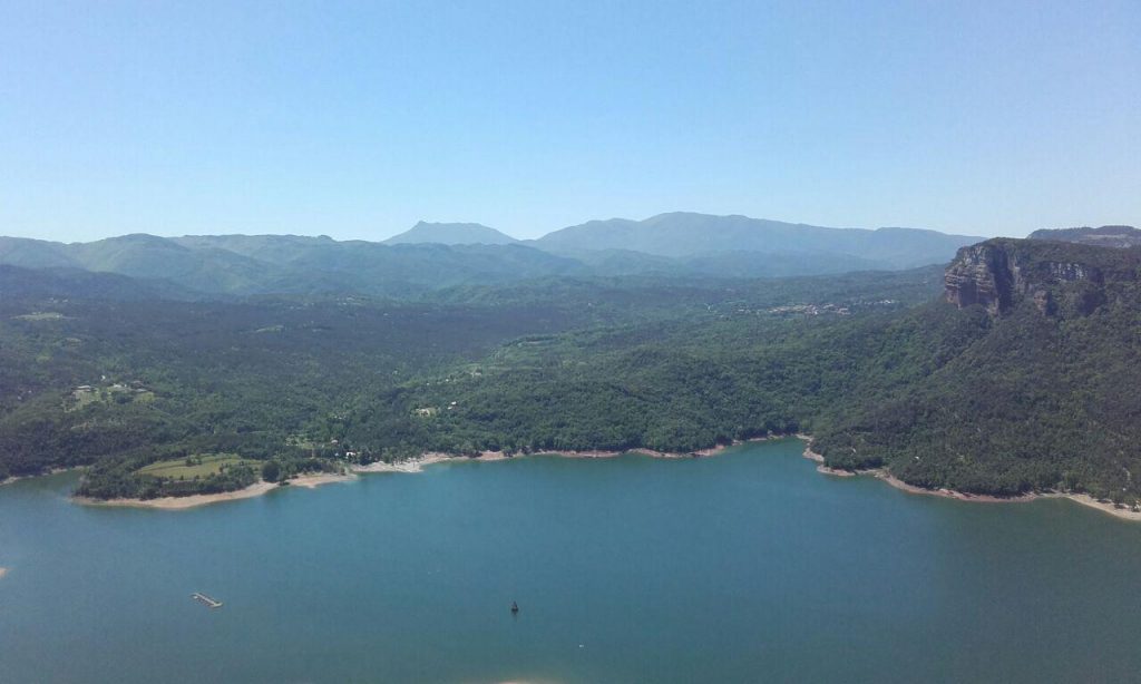
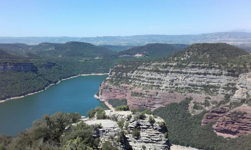
The place: Pantà de Sau
Pantà de Sau (in English: Sau Reservoir) is situated in Vilanova de Sau and belongs to the basin of the Ter river. The dam was completed in 1962 and water flooded a town called Sant Romà de Sau, whose remains are still visible, for example the top of the Church of Sant Romà, when the water level is low.
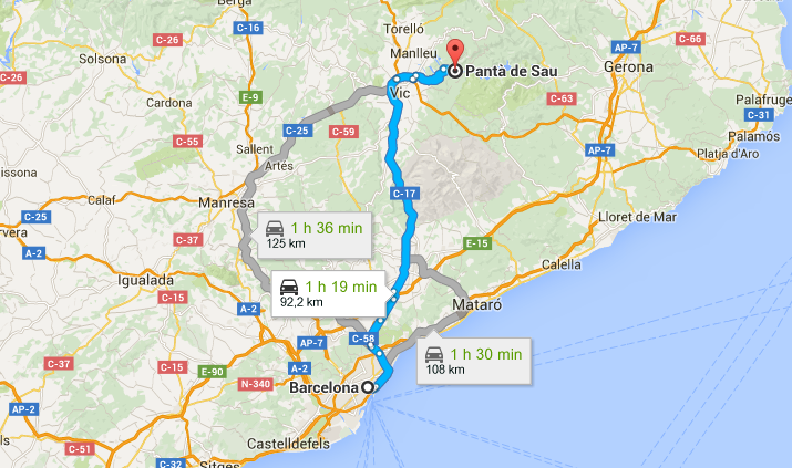
Regarding the distance from Barcelona, it is just 1h 45 by car from the city center:
The route
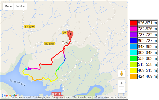
There are different routes to do in this zone, but we chose the route that starts in Tavertet and follows this trail: Tavertet- Puig de la Força – Pantà de Sau – Tavertet. It is circular, which means that you don’t have to hike path back. The level is medium, the walking distance is 12,16 km and it has a positive slope of 600 metres.
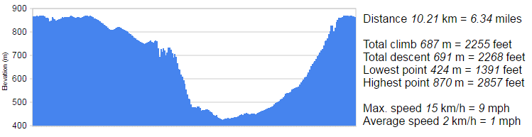
Here you can see the slope clearer:
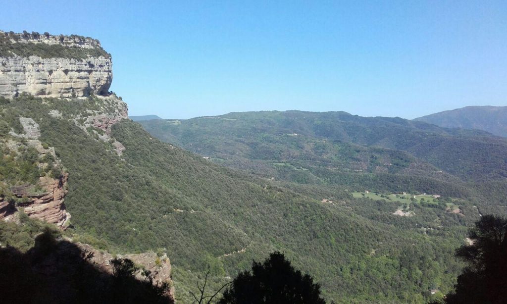
The route starts with a trail where you can enjoy the views of the mountains and the reservoir. Then, after passing through a kind of “skywalk” (where there is a Nativity Scene made of clay), you arrive at the Puig de la Força, a rock that makes natural and stunning views of all the landscape. Afterwards, you have to retrace your steps to the info point and take the path to the left. This is the difficult part of the route as it is a rather steep trail that goes through the forest and where the ground slides quite a lot. You have to descend carefully and slowly, otherwise you can throw stones and hurt the people that go ahead of you. Although it was the most difficult part of the trip, it was also the funniest one! This is the moment when you can see who the hiking experts of the group are (thankfully they helped the beginners!).
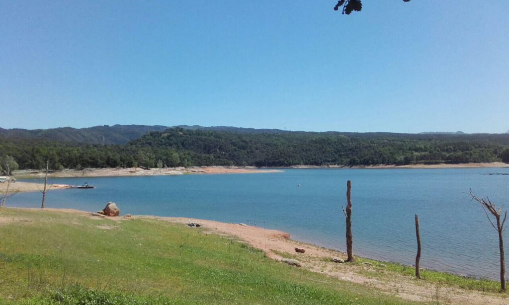
Once you arrive at the dam you can take a dip. Allright, the water is not the cleanest one ever, but it is good enough to cool off and continue your way! When we went there, the dam was reaching its limit and we could see the bell tower of the submerged village church. The rest of the town was totally under water.
The way back to Tavertet is tiring but easy (compared to the first part of the trip) because the rise is gradual.
Some considerations
- Even if it is not an easy route, there were beginners (me included) in my group and we finished it without problems. We were a bit slow but it was normal because we are not used to this kind of trips. Still, having some help was really appreciated!
- You can reach this spot only by car. We checked if there was public transport in case we didn’t have enough cars, but we could not find any.
- There are different paths that you can take along this route. Some of them are more complicated than others so it is advisable to bring a printed copy of the route and/or your GPS to know which way to take in order to avoid unpleasant surprises…
-
There’s a restaurant in Tavertet, Can Miquel, where you can enjoy a cold drink after the long, hiking day. It is highly recommendable to complete a beautiful day in the mountains!