Hiking route to Rysy: the highest peak in Poland
Zakopane, 30th July 2018.
Today it has been one of the days that has marked my journey. When I arrived in Zakopane, I set out to hike the top of Rysy, the highest peak in Poland, at 2499 meters. Climbing to the top of a country is not an opportunity that comes up every day and it sounded very tempting. I knew it was one of the most challenging routes in the Tatra Mountains and, since I started working at the hostel, only one person had made it. I was very curious to see if it was as difficult as it seemed and to test my physical and mental limits.
Quick facts about Rysy
The term “Rysy” means “scratches” or “cracks” and refers to the grooves in the steep summit. The mountain range is located right on the border between Poland and Slovakia, although only 30% of it is on the Polish side. Rysy has three peaks: the central one, at 2503 meters; the southeast one, at 2473 meters; and the northwest one, at 2499 meters. The latter is officially the highest peak in Poland as the other two are on Slovak territory.
The hiking route to Rysy is very challenging for several reasons. First, because it is a very long excursion (the whole trip can easily take about 12 hours). Second, because the last few hours have to be done with the help of chains over a fairly steep terrain. And third, because it is very important that the weather is good and this is not always the case, even in summer. In short, you need to be physically and mentally prepared and be lucky that there is no rain forecast the day you are planning to go.
The importance of the weather
The weather is one of the most decisive factors when it comes to climbing Rysy. If the weather conditions are unfavorable, it can be very dangerous. If you are in the middle of a hike in the mountains, and suddenly it starts to rain, lightning causes landslides, you can get hurt. In fact, our hostel manager warned us that every year, people who don’t consider the weather forecast die trying to reach Rysy.
Last week it rained almost every day and it was impossible to make the trip. However, my colleague Jonathan didn’t give up and tried twice. The first time he went with Karl (another volunteer of the hostel) and the weather was so bad that they could not continue beyond the two lakes (Morskie Oko and Czarny Staw pod Rysami). The second time he went alone and he made it until the second part of the chains because there were lightning and rocks falling down. He and the other hikers had to turn around quickly.
This weekend, I agreed with Andy (a guest from Australia) and my friend Karolina that, if the forecast was good, we would do the hiking route to Rysy today. Jonathan had tried just yesterday, but according to the Internet, the weather forecast looked better today. It was expected to be sunny in the morning and stormy in the afternoon/evening, but we were aiming to be back by then. We didn’t imagine that the hiking route would take THAT long.
Although the initial idea was indeed to climb Rysy, we knew that reaching the top was unlikely to happen given the circumstances. However, we decided to try and see how far we could go. If the weather turned against us or we were too tired, we would turn around.
The first part: from Zakopane to Morskie Oko
We met at 6:30 AM at the hostel to have breakfast before taking the bus to Morskie Oko, the starting point of the route, at 7:30. At the entrance of Palenica Białczańska, we bought the tickets to the National Park and started walking towards the lake. As in the previous hiking route to Morskie Oko, we did this part walking on the paved road, as it is the only way option. Nevertheless, there are a couple of shortcuts where you can do a little hike in the nature.
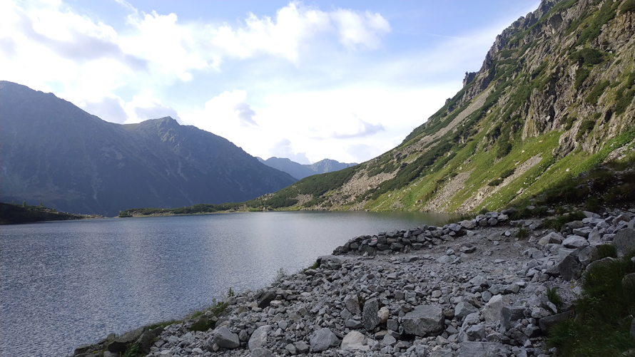
We arrived at Morskie Oko in 1:40 hours, and the first thing we did was to have a proper breakfast in the mountain hut. We were very hungry and we knew that we had a very long hiking rout ahead, so we took advantage of this first stop to get our strength back. I ordered scrambled eggs with sausages at “tourist price” because the quantity left much to be desired for what it cost. However, it was either that or nothing, because there was no other place to choose.
As we were having breakfast on the terrace, we looked at the mountains and saw how the peaks were completely covered by grey clouds. This was not a good sign because it meant that it was very likely that it would rain or that the weather would be bad on the top of Rysy. On the other hand, my friend’s knee started to hurt a lot and she decided to stay in Morskie Oko and go back to the hostel. Hiking Rysy with joint pain was not recommended at all. However, Andy and I wanted to give it a chance so, after breakfast and saying goodbye to Karolina, we set off for Rysy summit.
Second part: from Morskie Oko to Czarny Staw pod Rysami
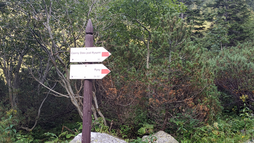
We surrounded Morskie Oko until we reached the sign that indicates “Rysy – 3:50 hours”. This is where the ascent as such began, as the path had been practically flat so far. However, all this previous part was good to warm up our muscles before getting serious.
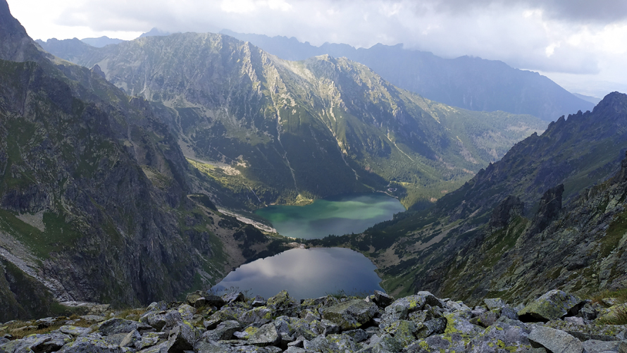
The climb to Czarny Staw didn’t feel technically difficult to me, but it was tiring because the path was very steep. Unlike my partner, I had to stop every 5 minutes to get some air and drink water, but one step at a time, we went up, and finally, we reached the second lake. It took us about 45 minutes from Morskie Oko’s mountain hut.
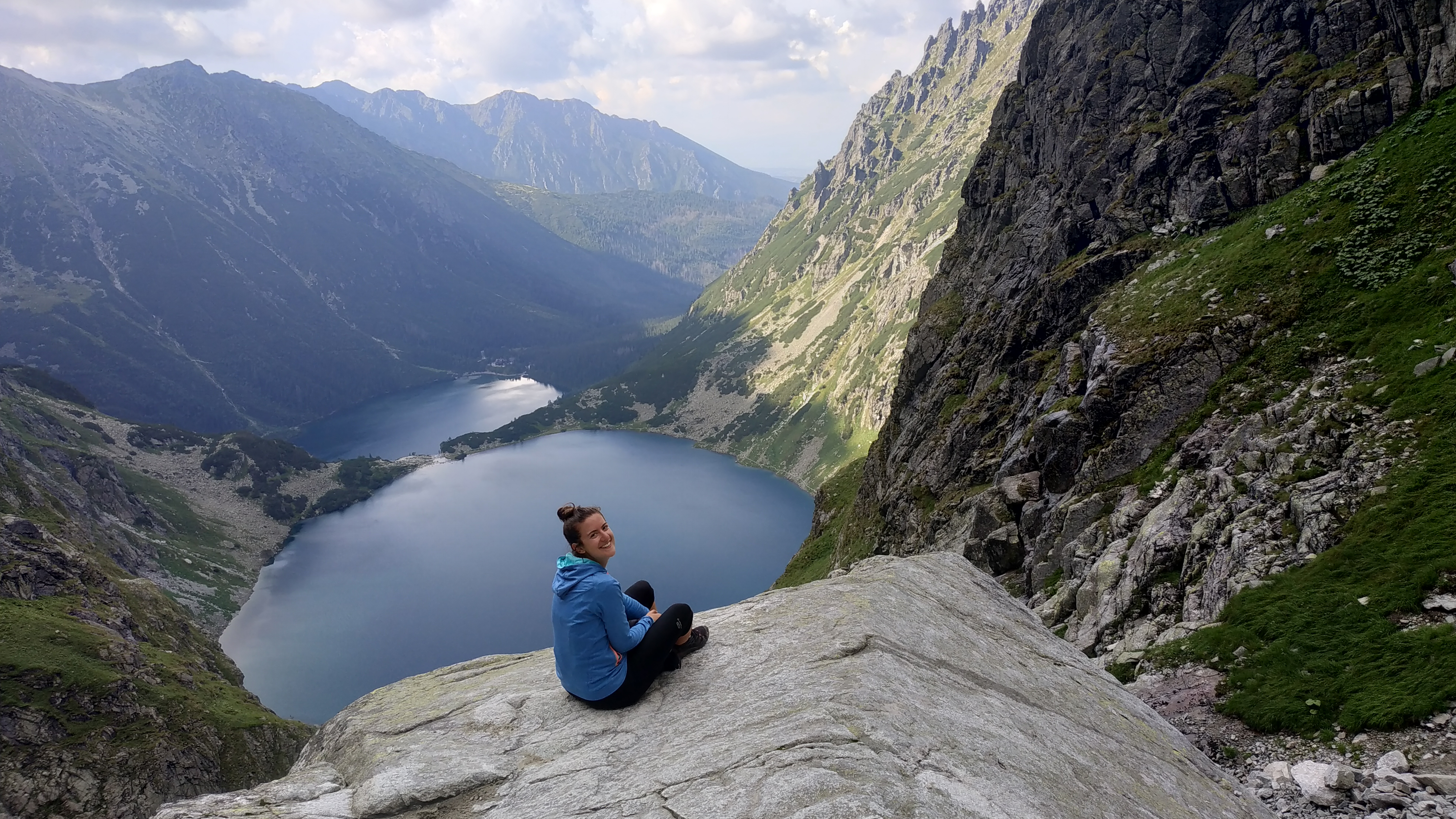
Personally, I found Czarny Staw Lake more special and peaceful than Morskie Oko. There were fewer people and you could tell it wasn’t as touristy (maybe because of the steep way up?). Also, the fact that it was in a higher area and located just below the imposing Rysy mountain range made the views even more impressive.
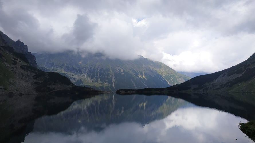
From here, we started the next stage of the hiking route: to surround the lake until taking the path up to Rysy. Along the way, we were looking at the mountains that stood before us. Indeed, the peaks were still completely dark and hidden by the grey clouds.
Third part: the climb from Czarny Staw
The rocky part
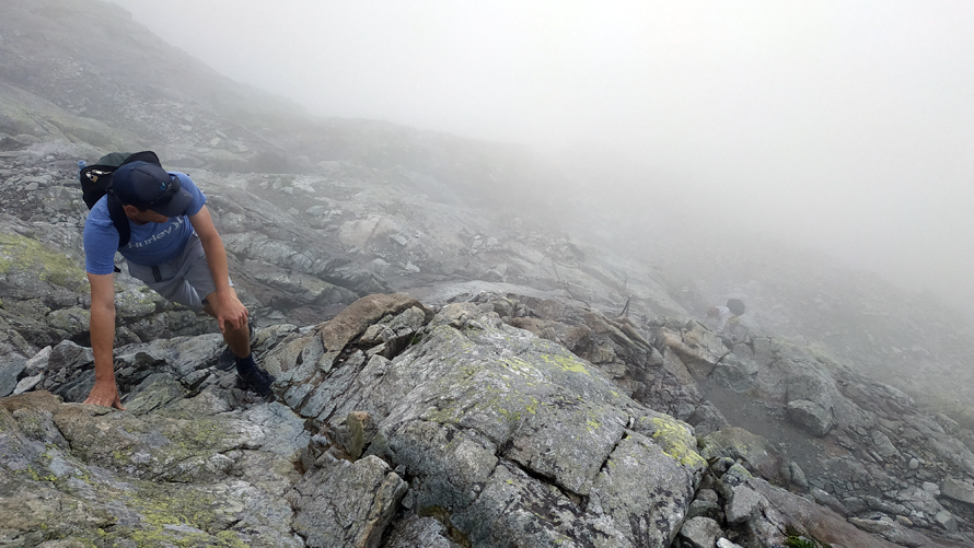
After surrounding Czarny Staw we continued along the red trail, which is an ascending path of stones and rocks. This was an easy but tiring trail because there was no flat part at all. At some points, you had to climb some rocks and use your hands as the terrain was very steep. There were also sections where the surface was slippery and you had to be careful not to fall.
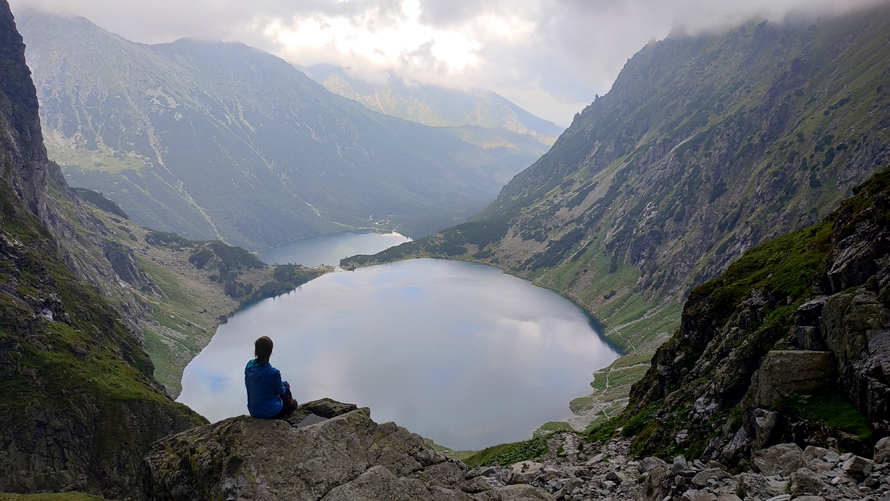
There were spots where you could sit on a rock and enjoy the breathtaking views of the lake and the Tatra Mountains behind. As we climbed, we were looking back all the time to see if we could see the two lakes from where we were. We knew we would get there at some point because Morskie Oko is lower than Czarny Staw and would have to appear behind it sooner or later. However, we could see Czarny Staw but no sign of Morskie Oko. It wasn’t until quite a while later that we started seeing both lakes.
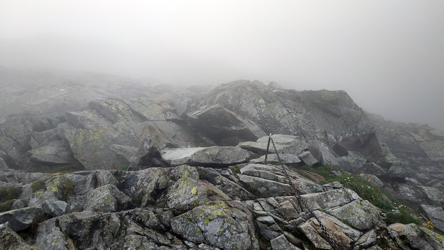
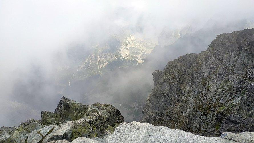
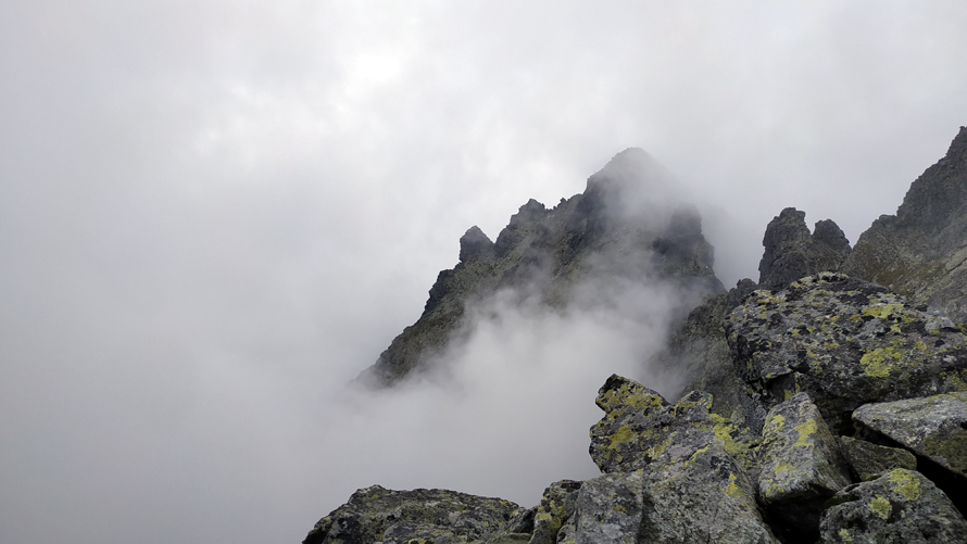
As we climbed to Rysy, the path became narrower. Besides, the fog was more and more evident and there was a time when we could not see the way we had come from. We could see neither the lake, nor the mountains, nor the path, nor the sky… Nothing. We were totally surrounded by clouds. We could also feel the change in temperature because it was colder and we had to put on our jackets.
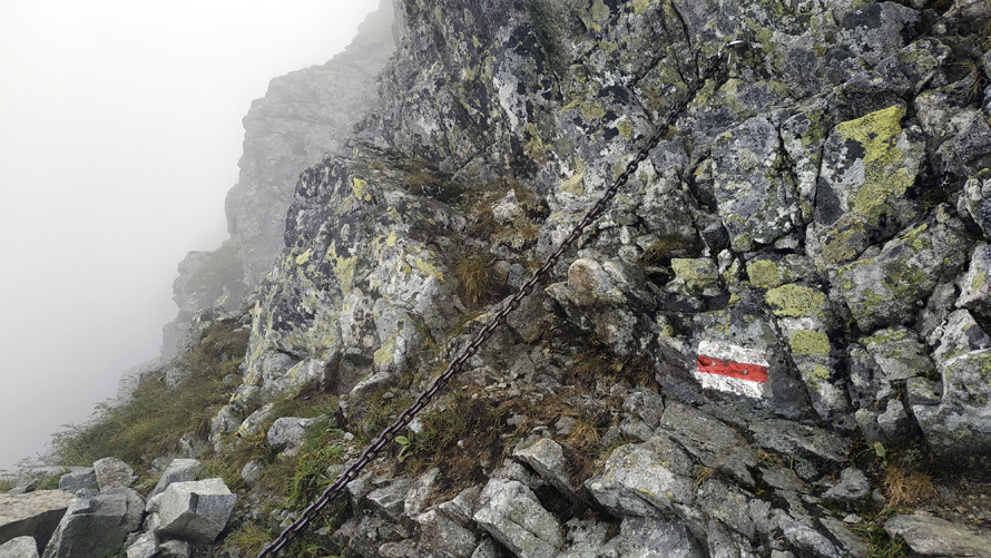
Arrival at the chains’ part
Step by step, we reached the part where the climb with chains began. This was already quite an achievement because we didn’t expect to make so much progress on the hiking route to Rysy. However, it was clear that the weather was not with us and that it could start pouring at any moment. The problem was that we had no waterproof clothes or mountain equipment at all, so it was not a plan to risk lives.
Before we started the chains part, we asked a couple of hikers who were coming back from Rysy to evaluate the situation. Everyone, absolutely everyone, told us not to continue. They said that it was too late, that there were two more hours to the top and that the weather was not promising. However, we thought that it was not that late, that we were not tired and that it was not raining, so we decided to go a little further…
And we started the chains part. Just after the first ones, there was a critical moment because we heard thunder. We were afraid that it would start pouring, so we thought we’d turn around. As a matter of fact, we did. However, because this is how life is, the sun suddenly came up again and we saw that the people who were near us were still there. So, again, we decided to give it a try and continue a little longer.
Along the way, Andy and I encouraged each other when we felt that the mood or strength to continue the hike was declining.
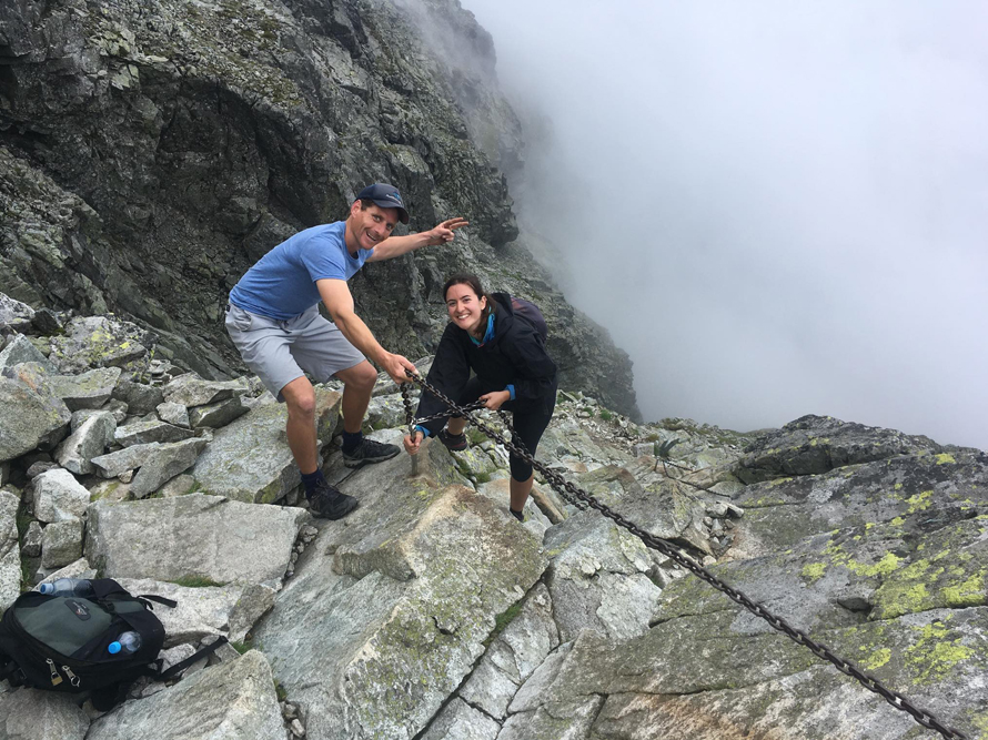
Fourth part: the climb with the chains
When we reached the chains my friend wasn’t very convinced but I felt like trying at least one part of it. We had come all the way there and I wouldn’t feel satisfied without even trying. We did a couple of chains and we saw that it wasn’t as difficult as we thought, so we continued.
At this point we were relatively close to Rysy’s peak, and we didn’t want to give up. We asked some hikers again how much time we had until the top, and they answered the same as before: we had two hours left (still?!!), the weather was unfavourable, and if we wanted to climb Rysy, we would have had to get up much earlier. However, we saw that people were continuing and we asked ourselves: if they can, why can’t we?
We climbed with chains for about two hours. I found this part relatively challenging and tiring, but not difficult on a technical level. I had never climbed with chains before (except for the day of the caves hiking route) and I was able to do it without problems, but you need to be physically and mentally prepared. In my opinion, the chains helped us a lot in some sections but there were others where they were not completely necessary. You could hold on to the rock and go to the next level without using them.
There were some moments when we could see both lakes if we looked down. However, most of the time there was so much fog that we couldn’t see almost anything of the landscape. On the contrary, the higher we were, the less visibility we had.
Fifth part: the final hike to the top
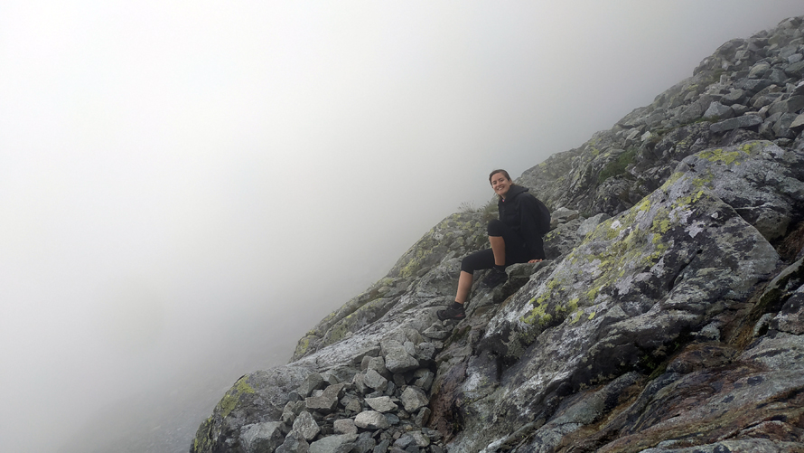
During the whole climb with the chains, we went along with a group of girls who were perfectly equipped with helmets, technical clothes and a backpack with mountain material. On the other hand, we were wearing nothing but our sports clothes and a small backpack with water and something to eat.
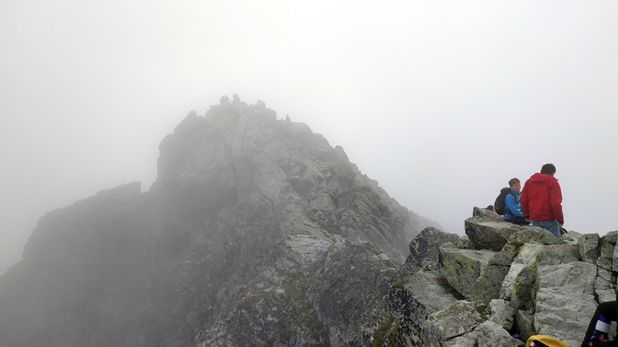
The last part of this hike was the one that gave me the most respect. The path was narrow and the slope very steep, and underneath we had nothing but the cliff. There were no rocks or any kind of surface, and if you put your foot in the wrong place, you could literally fall down. We were at all times “glued to the rock” and held on to the chains. To give you an idea, the path was as if we had to go around one mountain and stand on another.
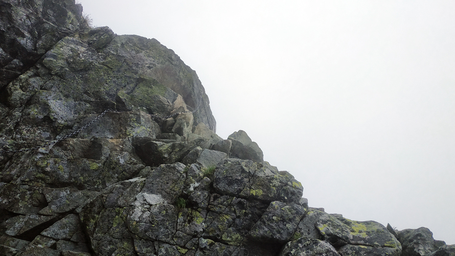
The weather was changing all the time. The fog came and went, and the landscape changed in a matter of seconds depending on whether we had the sun on our side or not. We were very lucky because it didn’t rain at all. And thank goodness… because I was wearing nothing but a plastic poncho.
I was very encouraged to see that the hikers ahead of us could continue the route without any problems. If they could, so could we! During the ascent, we met a group of very nice Spaniards coming from the top of Rysy. They told us that we only had 15 or 20 minutes left, so we put all of our last energy on it.
An important thing to consider…
Before continuing, I would like to highlight that I believe that the climb to Rysy’s summit is not for someone who is afraid of heights. You can have a hard time, especially from the beginning of the chains on.
To my surprise, I managed quite well during this part despite all the insecurities I had. Not only that, I realized that I enjoy these kinds of trails. I felt very comfortable going up the mountain and even overtook my colleague and other hikers who were going slower.
Sixth part: Rysy’s summit, here we are!
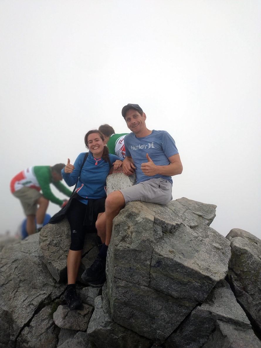
You can’t imagine how I felt when we finally reached Rysy’s summit. I couldn’t believe it… We had made it! Against all forecasts and with all the odds of being a failure on a hike, there we were. At 2499 meters, on the highest peak in Poland. We reached the top at 2:30 PM, after a six and a half hour hike. At the summit, there were about 30 people, many more than I imagined.
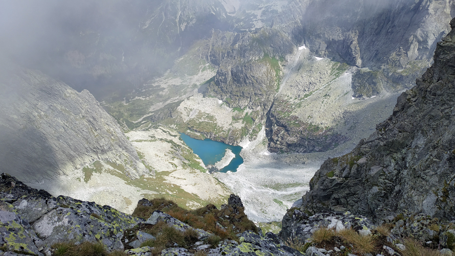
From the top, you could see both sides of the Rysy mountains: Poland on one side and Slovakia on the other. On the Polish side, you could enjoy privileged views of Morskie Oko, Czarny Staw and the Tatra Mountains. On the Slovak side, you could see the mountains and a small lake that stood out because of its turquoise blue colour.
We used our short stay at the top to eat something, recover our strength, take some pictures and enjoy the impressive scenery when the sun and the clouds allowed it. From there, we had the chance to continue to the other two peaks of Rysy, which are in the part of Slovakia. However, the weather suddenly changed and it began to cloud over. We were at the top for about 20 minutes and, given the forecast, we decided to start the way down.
Seventh part: the way down
From Rysy to Morskie Oko
There was a moment of tension because we couldn’t find the red trail signal to return. We went down the way we “thought” we had come but were totally out of place. Besides, there was no one to ask and we saw ourselves wandering around the mountain with no direction. Luckily, a few minutes later a group appeared and showed us how to get to Morskie Oko.
We couldn’t see anything underneath because of the fog. In fact, we couldn’t see anything within a few feet of us. We were a bit concerned, so we started to go down quickly so that we wouldn’t get caught in the rain.
For the descent, we used the chains less and preferred to go down “on your ass” on most sections because it seemed easier and safer. On some occasions, we did use the chains and went down on our backs so as not to slip. Once we finished this part, we joined the slippery rock path to get to Czarny Staw. From there, we bordered the lake and went down again to Morskie Oko.
Of course, now that “the worst” part was over, we took some pictures on the way down:
From Morskie Oko to the bus
We arrived at the shelter very tired. The first thing we did was to spoil ourselves and ask for a couple of beers and something to eat. And you won’t believe what happened, but as soon as we went out to the terrace with our menus… it started raining! We were quite lucky because if we had taken a little longer to do the route, we would have been caught by the deluge in the middle of the mountain.
When the rain stopped, we continued our journey along the road to return to Palenica Białczańska. In total, it took us 6 hours to get down from Rysy to the entrance of the park. We took the bus back to Zakopane at 8:30 / 9:00 PM. We were among the last people who left the park at that time and the bus was not full, contrary to when we arrived.
Back to the hostel
When Andy and I arrived at the hostel, my mates couldn’t believe their eyes. We are the second (after Jaden, a boy from America) to have reached the Rysy summit since I work at Good Bye Lenin Hostel. For the moment, I can already cross one of the “must-do things” off my list, and I can assure you that nothing is impossible if you put your mind to it. Never say never!
In this link, you can find the complete trail we did from Palenica Białczańska to Rysy, in case you want to take a look.